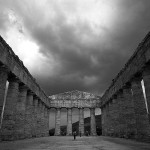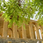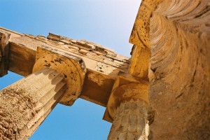
Selinunte is located in the Sicily southeast coast, in the province of Trapani. This is one of the main archaeological area in the Mediterranean region and it is the widest Greek structure. Selinunte is the name that Romans gave to the ancient Greek city Selinus. For its beauty this place can be compared to Syracuse or Segesta. Despite the outward status of decay, a guided tour will allow you to understand the great importance that this colony had in the past. The building of artificial hills on the perimeter tried to find the lost tranquility due to the construction of a road nearby.
History of Selinunte
According to the Athenian historian Thucydides, Selinunte was built by colonists from Megara Hyblaea (in the eastern coast of Sicily) in the seventh century b.C., about one hundred years after the Megara building. The name comes from a local plant, the parsley or sèlinon, widely diffused in the area. Afterwards, the population grew until 25.000 inhabitants and Selinunte turned into a powerful commercial centre in the Magna Graecia (Great Greece) and into one of the major Hellenistic cities. Its privileged geographical position near the sea allowed it to control the maritime traffic of the whole area, while agriculture and the breeding of horses strengthened its own economy.
Selinunte experienced a permanent conflict with Segesta – who was allied with Athens – whose expansion was not compatible with the Selinunte one. When Athenians were defeated by Syracuse, Segesta asked for help to Carthage. In 409 b.C. the city was besieged for nine days by an army of 100.000 Carthaginians landed in Sicily. According to the contemporary historians, this defeat caused to Selinunte a heavy toll in human lives with 16.000 victims and 5.000 prisoners forced into slavery. The temples were sacked and many building were partially destroyed.
Despite the city walls were also destroyed in order to prevent new forms of defence, Selinunte survivors were allowed to continue their own lives as usual, paying tribute to Carthage. About a thousand citizens settled in the city under the guidance of Ermocrate. In 405 b.C. the treaty between Carthage and Dionysius I of Syracuse confirmed Selinunte under the Carthaginian occupation, bringing an era of substantial peace, but the city never came back to its former glory. Indeed, during the First Punic War, it was destroyed again during the escape of the Carthaginians from the Romans.
After that, small communities of hermit monks lived in the ruins of the acropolis during the byzantine period, dropping a veil of oblivion on the past. Moreover, it was struck by some earthquakes that destroyed the foundations of the city, until the historian Fazello identified it again in the sixteenth century. In the nineteenth century other archaeological works unearthed the Selinunte remains.
Archaeological Site
The current archaeological structure is divided into four areas: the temples in the eastern area, the acropolis, the ancient city and the sanctuary of Malophòros. The temples are marked with letters, because of the impossibility of cataloguing accurately each god or goddess to which they were dedicated. The nearby Cusa quarries allowed analysing the whole process from the stone extracting up to their arrival to the temples. An excursion to the quarries – a full of orange groves and olive trees environment – give us the grandeur of the works of stone extracting, stopped with the destruction of Selinunte.
Despite it is probably that you get lost sometimes, it is worth to arrive to the Cusa quarries. They are located in the middle of Sicilian countryside, totally abandoned among olive trees, bushes, fig trees e almond trees. Fortunately, the sudden interruption because of the attacks of the Carthaginians in 409 b.C. gives you a perfect idea of how stone was extracted and transported from this kind of lab created for the building of Selinunte.
The quarries have blocks of stone that can be extracted, well-cut and ready for being transported to Selinunte (approximately 20 kilometres far) by slaves and oxen with the help of wooden rollers iron reinforced. It can be also found broken blocks scattered around the world, medium-size capitals and empty hollows, which make fantasy grow about a so magnificent extracting work.
To reach the quarries, or at least try to do it, you have to drive for four kilometres from Selinunte towards north direction up to the intersection for Campobello di Mazara. After crossing the village take the detour for Tre Fontane, following the road for about two kilometres. Arriving there, you will find a rough road for about 200 meters that will oblige you to keep a 10 km/hours speed for avoiding damaging your car. The temples in the eastern area are those that best represent the importance of Selinunte. The temple G, dedicated to Zeus or Apollo, had a peristyle made of 46 columns of 16 meters high and 10,5 meters of circumference, which gave it the dimensions of about 110 x 50 meters. It is one of the major temples of the ancient times, even compared to the one of the Parthenon in Athens. Its construction was started in 580 b.C. and one hundred years later, when the city was destroyed, it was not already finished. Currently, a column restored in 1832 stands alone, so the visitors can sense the grandeur of the temple.
To the left of the path there are the temples E and F. The second one, dated 560 b.C., is the smallest and worst preserved, and it is dedicated to the goddess Athena. Besides, the temple E (in Doric style) is dated to the fifth century b.C. and an inscription tells us that it was dedicated to the goddess Era.
Its dimensions are 67 x 25 meters and it has six front columns and fourteen side columns. The temple, destroyed by an earthquake, was reconstructed in 1960 and built again, recovering the remains of basis scattered around the ground.
Then, walking the path towards the seaside you will see the acropolis in the sea, one of the best and unforgettable Sicilian sights. The acropolis lies on an irregular esplanade and in the past it was surrounded by walls and towers, which gave it a defensive function to contrast the incessant threat represented by Segesta. The remains of six temples well-defined and other minor temples and structures were arranged on a path make of two crossing streets. Then, in the Punic area there are the remains of another area devoted to sacrifices, in whose tiles you can see the symbol of the goddess Tanit.
The temples O and A are the closest temples to the sea and they were probably entitled to Castor and Pollux. These temples, dated about 409 b.C., were characterized by a Doric style and periptera hexastyle plant. Instead, the Megaron and the temple B have ionic and Doric-Friso columns. This seems to be dedicated to Empedocles, the philosopher from Agrigento who was superintendent of sewage work of Selinunte. In the acropolis esplanade there is the temple C, dated sixth century b.C., probably named after Apollo.
In 1936 it was involved in the same process of anastylosis of the temple E. It is in archaic Doric style and is characterized by 6 front columns and 17 side ones. You can see the preserved metopes and a large mask of Gorgon in the museum of Palermo. Going back to the north there is the temple D, similar to the previous one. Here there is the area of the acropolis where houses, the market and craft shops were located. Near the acropolis entrance recent excavations unveiled remains of what was used as necropolis after the destruction of Selinunte in 409 b.C.
Outside the acropolis in a western direction you have to cross the Modione river, where there was one of the Selinunte harbours, in order to visit the sanctuary of Malophoros (sixth century b.C.) dedicated to Demeter, the goddess of fertility. Two altars and a sacred spring formed it, which still continued to be used after the fall of the city.


